The role of 3D modelling in the Australian mining industry
Mining

Mining
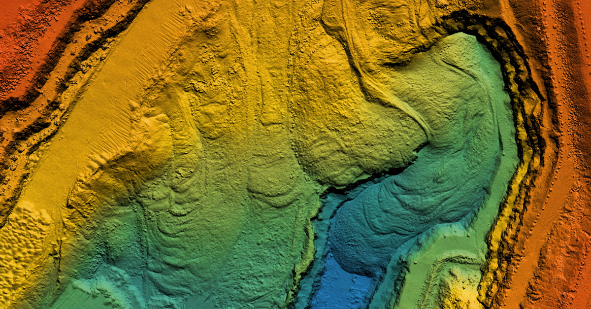
What if we could dig deeper, work more efficiently and be safer, without ever setting foot underground? In the mining industry, this isn’t just a dream - it's a reality, thanks to 3D modelling. 3D modelling is revolutionising the way mines are planned, managed and operated. From visualising underground deposits to simulating complex mining processes, this technology is changing the way companies approach everything from resource extraction to environmental management. In this blog, we explore how 3D modelling is reshaping Australia's mining landscape.
3D modelling is a vital tool in mining, particularly in Australia’s mineral and energy exploration. It helps geologists identify and estimate mineral deposits, which makes exploration more accurate. The technology is also key for geohazard analysis, simulating events like rockfalls or landslides to enhance risk management. In environmental applications, 3D modelling supports sustainable practices, reclamation efforts and regulatory compliance.
For mine safety, it enables the simulation of dangerous scenarios, reducing accident risks. Real-time, interactive 3D platforms improve collaboration among engineers, geologists and stakeholders, speeding up decision-making. Because 3D models reduce the need for expensive and time-consuming physical surveys, they are especially useful in remote parts of Australia, such as the Pilbara region in Western Australia.
Pilbara is a vast, sparsely populated area known for its harsh, rugged terrain and extreme weather conditions. Many mining sites in the region are located hundreds of kilometres from the nearest major towns or ports, and the area’s limited road networks and infrastructure make it difficult to transport equipment and personnel.
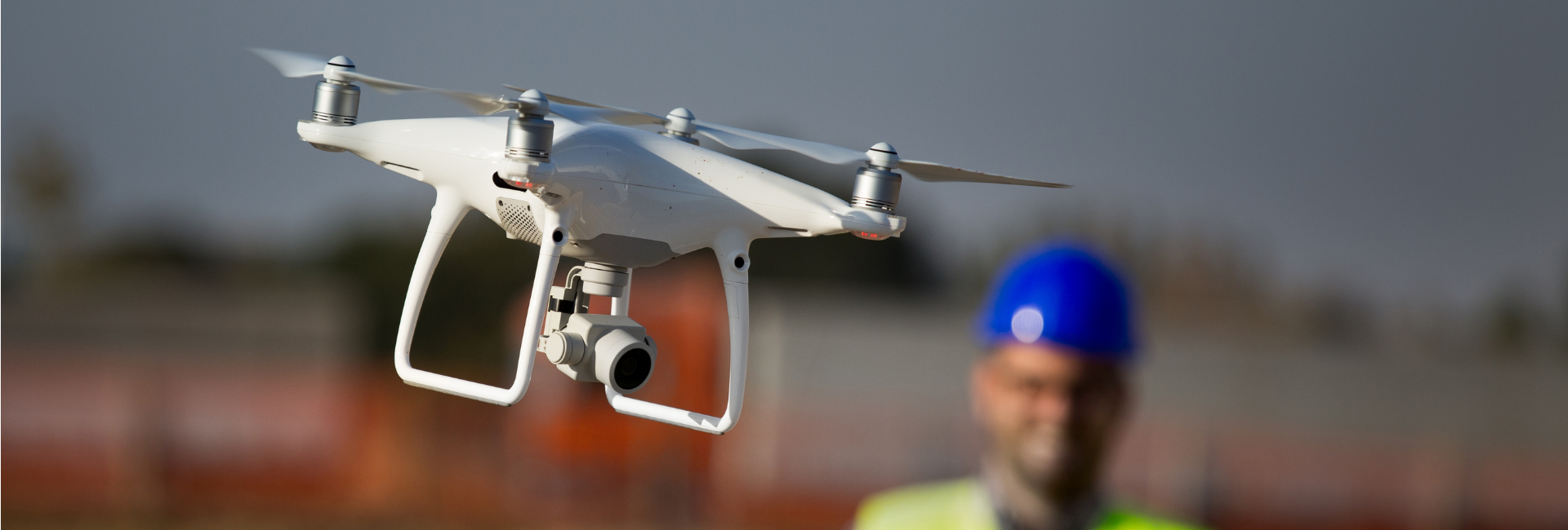
Traditional surveying methods can be expensive and logistically complex in such environments. By using 3D modelling with technologies like drones and LiDAR, mining companies can quickly gather accurate data from hard-to-reach areas, reducing the need for on-the-ground surveys and streamlining the planning process.
There are several advanced technologies that make 3D modelling possible in mining. Drones with LiDAR technology collect highly accurate site data, speeding up model creation and making it more reliable than traditional methods. Laser scanning, especially in underground environments, provides precise data on mine structures without risking worker safety. Virtual reality (VR) allows teams to fully immerse themselves in 3D models for design reviews, while augmented reality (AR) helps with real-time decision-making by visualising hazards and operational designs on-site. Artificial intelligence (AI) boosts the accuracy of 3D models by predicting mining conditions, while automation improves efficiency through predictive modelling and control of mining machinery.
Drones with LiDAR
LiDAR uses laser pulses to measure distances, creating highly accurate 3D models of landscapes. Drones make it easier to capture data from large and hard-to-reach areas, such as steep terrain or remote sites. This method is quicker and more reliable than traditional surveying techniques, providing detailed topography and mine features with millimetre-level accuracy. The data helps with resource estimation, mine planning, and environmental assessments.
Laser scanning
Laser scanning captures 3D data of mine structures, including tunnels, shafts and other underground features. They work by emitting laser beams and measuring how long it takes for the beams to return, allowing highly accurate 3D models to be formed.
Virtual Reality (VR)
VR lets teams fully immerse themselves in 3D models of mine plans, infrastructure and operational setups. With VR headsets, engineers and mine managers can "walk through" a digital version of the site before any work begins. This helps identify potential design flaws or areas for improvement in the planning stage. VR is also used for training, where workers can experience dangerous situations in a safe environment, helping them better prepare for real-world scenarios.
Augmented Reality (AR)
AR overlays digital information onto real environments, helping workers make real-time decisions while on-site. Through wearable glasses or tablets, AR can display important data, such as site maps, hazard warnings or equipment specifications, right in front of the user. This means that workers can see potential dangers (such as unstable ground) before they become a risk.
Artificial Intelligence (AI)
AI can enhance 3D models by predicting mining conditions based on data gathered from sensors, drones and other tools. It helps find patterns in data that can show potential hazards or operational issues, such as ground instability or equipment malfunctions. By forecasting these conditions, mining companies can take measures to avoid accidents or disruptions.

To enter 3D modelling in the mining industry, professionals need a blend of technical expertise and interpersonal skills. On the technical side, proficiency in software such as Vulcan, Deswik, AutoCAD, Autodesk Revit, and Surpac is essential. These tools are used to create and refine detailed 3D models of mine sites, so a strong understanding of their functionality is crucial. Knowledge of geology is also important, as professionals must interpret terrain and geological features to ensure models accurately reflect site conditions. The ability to analyse complex data is another key skill, enabling the creation of precise models that support decision-making and planning.
On the interpersonal side, communication is paramount. Mining projects often involve diverse teams, and clear, effective communication is vital for collaboration. Professionals must be able to explain their work, listen to feedback and adapt their models based on new information or changing circumstances. Teamwork, flexibility and relationship management are just as important as technical skills to ensure the smooth progression of the project and the delivery of accurate, practical models.

Creating and using 3D models in mining involves a team of experts working together, each contributing their specialised skills:

A great example of 3D modelling in action is BHP’s use of Hovermap, a mobile LiDAR system developed by Emesent, at its Olympic Dam mine in South Australia. Hovermap has helped the company transition from the well-understood NMA rock mass to the new SMA, offering insights into the new rock mass that were previously hard to gather. By allowing teams to safely scan areas that were once difficult to reach – such as voids, stopes, drawpoints and ore passes – it’s helped surveyors, geologists and engineers improve models, refine stope designs and predict stope behaviour with greater accuracy.
What started as a tool to scan stopes has grown to be used across the mine, mapping ore handling systems and vertical infrastructure, while identifying issues like ground deformation. Thanks to easy-to-use data capture methods – including vehicle, tether, handheld and drone – the team can collect useful data that can be used to inform decisions.
3D modelling is transforming the Australian mining industry, making it safer, more efficient, and environmentally responsible. Through the use of advanced technologies like drones with LiDAR, virtual and augmented reality, and artificial intelligence, mining operations are able to plan and execute projects with greater accuracy and less risk.
This technology is especially valuable in remote areas of Australia, where traditional surveying methods can be costly and challenging. By allowing engineers, geologists and other professionals to work together more effectively, 3D modelling is improving decision-making and helping to minimise environmental impact. As these tools continue to advance, they will undoubtedly play an even bigger role in shaping the future of mining, ensuring a more sustainable and safer industry for years to come.
Brunel's mining industry experts can support you to successfully identify, attract and deliver skilled blue and white-collar personnel and solutions matched to your business’ unique requirements. Whatever complexities you face, Brunel is here to simplify them.